
Walk Cupertino Streets by Address
A Cupertino street directory search is strongest when each address becomes a parcel record before it becomes a person question. Standardize the street suffix, direction, unit, and number, but preserve the form printed in an older deed, permit, map, or newspaper. Santa Clara County's assessor can return an APN and recent title-changing document. Cupertino GIS can then show the parcel and its touching polygons. The Recorder follows parties and document numbers, not street addresses, so the APN is the bridge between the modern map and the deed chain.
- Normalize the address and note every known spelling, direction, unit, and historical place label.
- Run the address in Santa Clara County Real Property Search, then save the APN, situs, and latest title-changing document number.
- Open the Cupertino parcel map and click the target polygon and each parcel that touches it, keeping front, rear, and corner relationships separate.
- Use the latest document number to begin the Clerk-Recorder chain. Treat the voter tool as a self-check, not as a public list of people along the street.
- Browse Cupertino permit folders by street and number, then consult verified historical newspapers, maps, or criss-cross volumes for past household clues.
The chain answers different questions at each stop. A parcel can identify ownership and land context. A deed can name parties to a transfer. A permit can place a contact beside a project date. A directory or newspaper may connect a past household to an address. When the goal shifts from a whole street to one person, use the Cupertino resident lookup path and add a second identity anchor.
Cupertino Street Assessor Fields
The Santa Clara County Real Property Search has three modes: Simple Address Search, Advanced Address Search, and Search by APN. The county form is built around situs, meaning the physical parcel location. It is not an owner-name search on the public assessor interface. The city Property Information Map separately advertises owner-name search, so a county result and a city-map result should be treated as related but distinct evidence.
The Santa Clara County property-search screen shows the address and APN route used at the start of the address search.
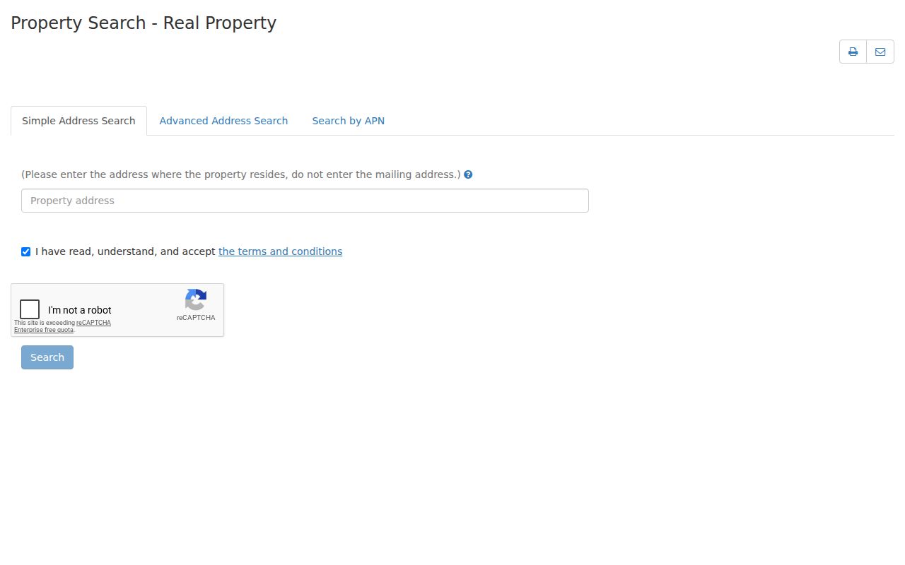
The image points to the county custodian's own search form. A returned APN is the stable handle to carry into GIS, permits, and a later deed lookup, while the mailing address is only the tax-contact route shown by the assessment record.
| Field | Type | Required | Format or note |
|---|---|---|---|
| Property address | Text | Yes in simple mode | Situs address, not owner mailing address |
| Street Number | Text | Yes in advanced mode | Pair with street name |
| Street Direction | Dropdown | No | Values supplied dynamically |
| Street Name | Text | Yes | Advanced address field |
| Street Type | Dropdown | No | Dynamic options |
| Unit | Text | No | Use for a unit when present |
| City | Dropdown | Yes | Choose Cupertino for incorporated parcels |
| APN Number | Text | Yes in APN mode | 12345678 or 123-45-678 |
| Terms checkbox | Checkbox | Yes | Accept before Search |
| Search modes | Tabs | No | Simple Address, Advanced Address, Search by APN |
Parcel results may include APN, situs address, recent transfer document number, property type or use, assessed land and improvement values, assessment year, map links, and parcel characteristics. They do not provide a household-member list or utility subscriber data.
Cupertino Street Parcel Adjacency
GIS adds geometry that an assessor result cannot. Search by APN or street address, zoom to parcel scale, and use the map to separate a same-street parcel from a rear-lot parcel or a corner parcel. The Santa Clara County GIS portal adds jurisdiction, zoning, development activity, flood, fire district, sanitation, watershed, geohazards, sphere of influence, and forthcoming-annexation context. County city-parcel planning detail can be limited, so Cupertino's own map is the useful local follow-through.
The Cupertino parcel and property map is the direct source for the map view used in the parcel workflow.
After selecting the target polygon, record its APN and click each touching polygon in turn. Visible street labels and parcel boundaries help distinguish a back parcel from a neighbor across the road. The published map service supports selection of up to 2,000 features, but it is not an occupant-radius search.
The county's Property Explorer is replacing two older property applications in 2026 and combines parcel detail, an interactive map, and layers. Use a map to describe geography, not to infer family ties, association membership, or who is physically present.
Cupertino Street Records at a Glance
Address-keyed records in Cupertino form a chain rather than a single resident list. The assessor establishes the parcel handle. GIS shows touching land and jurisdiction. Permits place work and public project contacts on an address. The Recorder connects a known document to parties and legal descriptions. Historic material can add household context, while the voter file remains restricted.
| Record set | Keeper | Street evidence | Access |
|---|---|---|---|
| Assessor search | Santa Clara County Assessor | Parcel, situs number, APN, assessed facts | One address or APN at a time |
| Property Information Map | City of Cupertino | Address, owner option, APN, land and building context | Online within city jurisdiction |
| GIS parcel map | County and Cupertino GIS | Touching parcels, boundaries, zoning and district geography | Map browse and click |
| Deeds and liens | Clerk-Recorder | Named parties, title history, legal parcel | APN or document bridge, then office index |
| Building permits | Cupertino Community Development | Work dates, scope, project address, public contacts | Accela or Laserfiche |
| Voter file | Registrar of Voters | Address data only for approved purposes | Not a public block directory |
| Historic media and directories | Cupertino Library and regional libraries | Older address and person evidence | Library access, exact runs need verification |
Keep the APN, street form, document number, and date in the same notes. That bundle makes it possible to test whether a permit, deed, newspaper item, and parcel refer to the same land even when a name or address changes.
Cupertino Permit Folders by Street
Laserfiche supplies a folder path that is especially useful when an address question concerns a building's past. Browse Public Records, then Building Department, then Building Permits, then the street-name folder, and finally the address-number folder. The city's Template Search supports the building-record template. This path can reveal work dates, project scope, and applicant or owner contacts when public, while the record number and parcel help match the file to the assessor roll.
Cupertino's building-record resources explain the Accela and Laserfiche channels. A permit is evidence that a project was filed or issued at an address. It does not prove that a named applicant lives there, and it should not be used to turn a project contact into a personal directory entry.
Note: Browse the street folder first, then open the number folder so nearby projects remain separate from the target parcel.
Cupertino Accela Address and ZIP Filters
Cupertino Accela lets a search begin with Site Address, Contractor License Information, Parcel Number, Record Information, or Contact Information. Past-record searching needs no account, while applications use a separate workflow. Date and type narrowing can keep a ZIP-wide query manageable, but the research does not state a result limit. The live permit search is therefore a useful address evidence source, not a complete resident list.
The Cupertino Accela permit search screen includes the address and ZIP controls shown below.
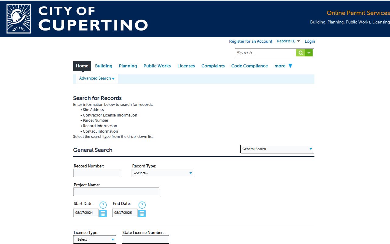
The screenshot links the field list to the city's own permit system. A result can provide record number, record type or status, application or issue date, project description, address, parcel, and public professional or owner contacts.
| Accela field | Type | Format or use |
|---|---|---|
| Search type | Dropdown | Site Address, Contractor License Information, Parcel Number, Record Information, Contact Information |
| Record Number | Text | Exact or known permit identifier |
| Record Type | Dropdown | Dynamic building-module types |
| Project Name | Text | Project label |
| Start Date and End Date | Date pair | MM/DD/YYYY |
| Street fields | Mixed | Street No., Direction, Street Name, Street Type |
| Unit fields | Mixed | Unit Type and Unit No. |
| Parcel No. | Text | APN |
| City, State, Zip | Text | ZIP accepts a five-digit entry |
The county assessor has a City field but no ZIP field, while Cupertino Accela has City, State, and Zip. That difference is useful when narrowing permits, but the parcel and jurisdiction still need independent confirmation.
Cupertino Deeds Need an APN Bridge
The Clerk-Recorder cannot start with a street address. Translate address to APN and latest document number first, then search the named parties and year at the office. Santa Clara County withdrew remote grantor-grantee searching on November 5, 2018. Public workstations cover 1981-present; Digital Reel covers 1850-1980. Index modes include document number, date, class, APN, grantor, grantee, or a combined party search, but addresses are not indexed.
The Santa Clara County Official Records channel leads to the counter and copy information. The county's deed-index instructions explain workstation coverage and the address-to-document method, while its record-search guidance confirms why the remote grantor-grantee index is no longer available. The index can show the grantor and grantee exactly as recorded, document number, recording date, and document type or class. The image can show the buyer, seller, legal description, APN when supplied, return or mailing address, and substantive terms unless lawfully redacted. Pre-May 1, 1995 records may be ordered by book and page; later documents use a serial or instrument number.
Busy periods may impose a one-hour workstation session, and the county recommends arriving early. A current driver license or ID is held while using book or microfilm resources. After opening a deed, take the seller or grantor and search that party as an earlier grantee. Confirm APN and legal description at every link because one person may convey several parcels.
Cupertino Street Labels Before 1955
Older Cupertino records do not always use Cupertino as a municipal label. Santa Clara County was organized in 1850, but Cupertino remained agricultural and unincorporated for the first century of that record run. Cupertino incorporated on October 10, 1955, after a September 27 vote, becoming the county's 13th city. A deed, census, map, or newspaper from before incorporation may instead use Santa Clara County, Monta Vista, West San Jose, or a township or community label.
No locally documented citywide street-renumbering year was verified. Preserve the APN, subdivision, tract, lot, and legal description instead of silently forcing an old address into today's format. Test historical text for Stevens Creek Boulevard, De Anza Boulevard, Torre Avenue, and Saratoga-Sunnyvale Road or Highway 9 variants. Monta Vista and Rancho Rinconada can also be useful search terms, but neither label alone proves the present city boundary.
When a name or number changes, compare the legal description and parcel history across the deed, permit, newspaper, and map. The street directory becomes more reliable when the land identity stays fixed while the wording is allowed to change.
Cupertino Criss-Cross Directory Clues
A reverse or criss-cross directory can turn an old street number into a household clue. The reverse section commonly runs from street name to number order to a named occupant, and may include a telephone entry. An alphabetical entry may supply a surname, given name, spouse in parentheses, home address, and marks such as “r” for resides or “h” for householder. These are reading conventions, not proof that a particular volume covers every Cupertino address.
No official catalog page verified a complete Cupertino-specific publisher or year run. Cupertino was often part of wider San Jose or Santa Clara County telephone and suburban directories. SCCLD librarians can check catalog-only volumes, yearbooks, map editions, and obituary access. The California State Library directory collection and the San Jose Public Library California Room are regional fallbacks, and exact shelf call numbers should be confirmed before a volume is promised.
Pair consecutive years to narrow a move, then compare the result with the assessor or deed chain, permits, newspapers, and the 1950 census. The Cupertino city directory collections page owns the historical shelf details; the street directory uses the criss-cross method only as one address clue.
- Parcel
- A legally defined piece of land identified by an APN and related lot or tract descriptions.
- Situs address
- The physical location of the parcel, distinct from an owner's mailing address.
- Plat
- A recorded map or subdivision description that helps preserve lot and boundary identity when street wording changes.
- Criss-cross directory
- A reverse directory that starts with street and number order and may point to a named occupant or telephone entry.
Cupertino ZIP and City Mismatch
Postal geography does not equal municipal jurisdiction. ZIP 95014 is the principal Cupertino street-delivery ZIP, but postal addresses can extend beyond incorporated boundaries. ZIP 95015 is used for Cupertino post office boxes and cannot define a residential street block. A 95014 mailing label therefore does not establish that a parcel lies inside the city, and a 95015 box does not place a person on a street.
Cupertino's permit autocomplete is a useful jurisdiction test. The city says an address that fails to autocomplete or return a result may be outside city jurisdiction. Use county or neighboring-city planning records for that address even when USPS accepts Cupertino as the postal city. The county assessor offers a City field but no ZIP field, GIS can browse boundaries, and ZIP is not a verified primary property filter.
The USPS ZIP Code Lookup is the authority for a current deliverable address. Keep its mail-routing result separate from the situs, APN, legal description, permit jurisdiction, and municipal election geography.
Cupertino Voter Records Are Restricted
The county voter tool asks for first name, last name, birthdate, and a conditional driver's-license or state-ID route or last-four Social Security route. It is designed for a voter to verify a minimal registration record. It does not search by street, ZIP, or another person's name. Residence address, phone, email, and precinct information are confidential from the general public for at least 100 years under California Elections Code sections 2194 and 2194.1.
Approved election, scholarly, journalistic, political, and governmental requesters can seek specified voter-file data. The request form asks for applicant and organization details, contact information, requested geography and voter history, qualifying purpose, use description, acknowledgments, wet signature, date, fee, and payment. Mail the signed application and fee to the Registrar of Voters at 1555 Berger Drive, Building 2, San Jose. Candidate Services is 408-299-8639 and the Voter Registration Division is 408-299-8683. Requests are not fulfilled until the form and fee arrive.
The Santa Clara County voter-data rules make the street limit clear. The Registrar's contact page identifies the divisions that handle a permitted file request. A public Cupertino street directory cannot lawfully present a general list of voters. Safe at Home and other protected records require additional shielding, and returned election mail can place a registration inactive until corrected.
Limits of a Cupertino Street Directory
A street directory can describe parcels, owners where public, recorded parties, permits, and historical clues. It cannot reveal every person connected to a property. The assessor has no household-member list or utility subscriber data. A property-owner map is not a neighbor map: an owner may live elsewhere, a trust or entity may hold title, and protected people may be suppressed. The voter file is restricted, and DMV address information is controlled by the federal Driver's Privacy Protection Act, 18 U.S.C. sections 2721-2725.
Lawful personal use. Use Cupertino street and address records for family history, civic research, property questions, or careful record verification. Do not use a parcel, deed, permit, voter result, or map to stalk, harass, threaten, or intimidate anyone. California Penal Code section 646.9 addresses stalking, and Civil Code section 1708.7 provides a civil stalking cause.
Cupertino's GIS Neighborhoods and HOA layer supplies geographic context, including named areas such as Adobe Terrace, Allario Center, Arioso, Astoria Cupertino, BeekMan Place, City Center, Cupertino Countrywood, and Cupertino Village. A polygon name is not an association roster. Voluntary Block Leader contacts are gated to registered leaders, and private organization lists should not be treated as public records.